

FUJIMORI Terunobu’s “Origins of Architecture” Series No. 16:
The Earth's Memory: Landscapes Shaped by Nature and Human Life
The Toraja Highlands: Where the Living and the Dead Remain Connected (Sulawesi, Indonesia)
The Indonesian archipelago lies along the boundaries of multiple tectonic plates within the Pacific Ring of Fire, where tectonic activity continues to shape the landscape to this day.
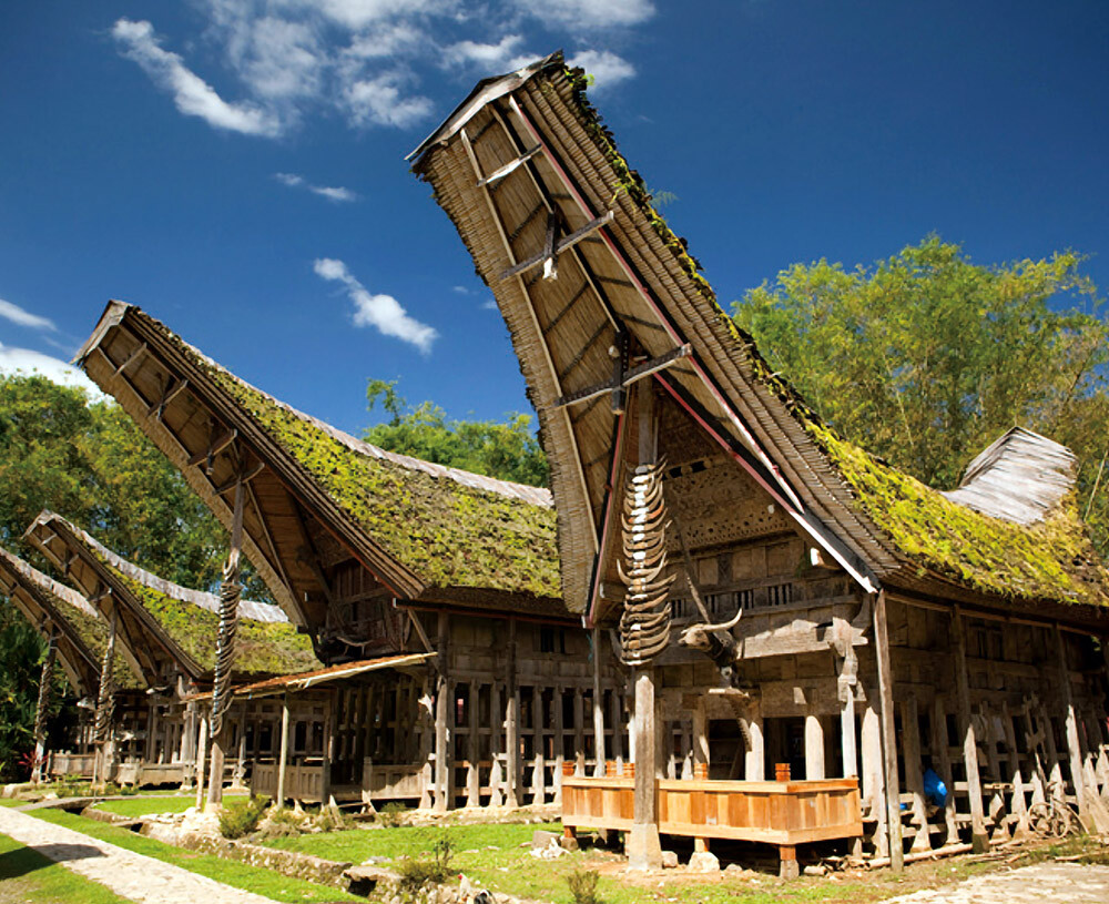
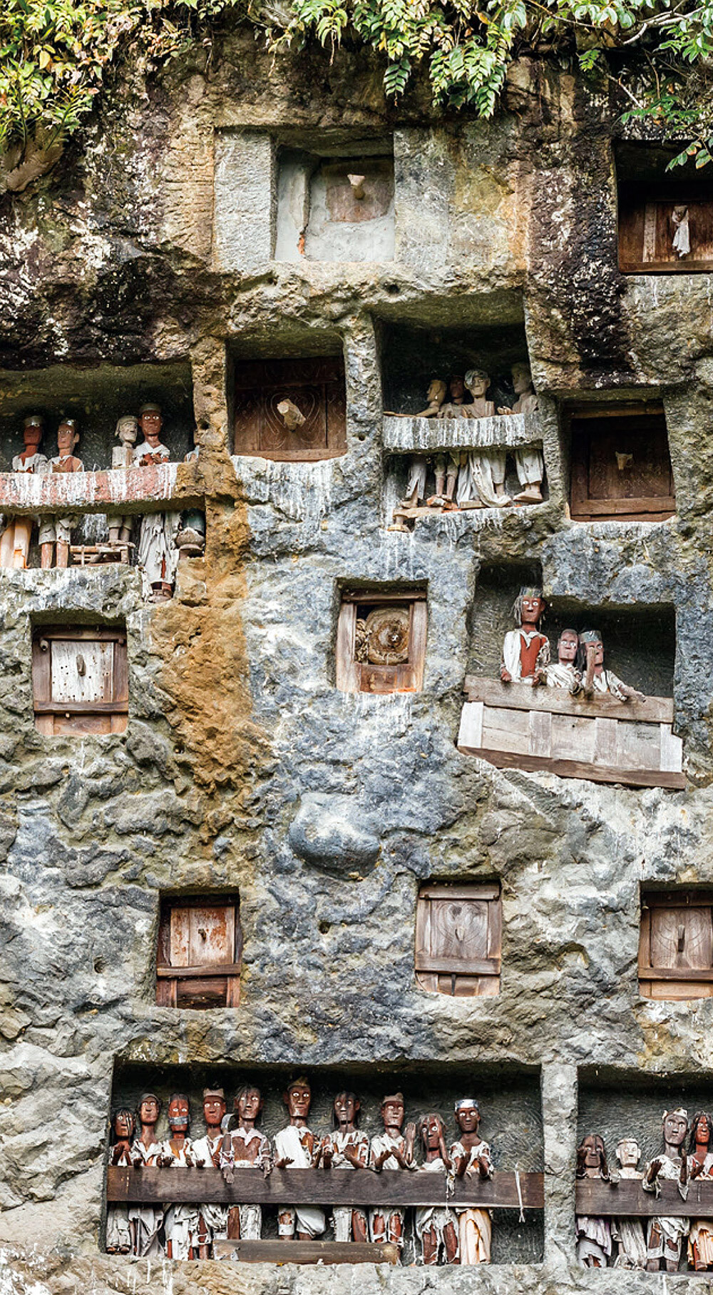
The Toraja Highlands, situated at elevations of 1,000 to 1,800 m in southern Sulawesi, are surrounded by towering limestone cliffs. The Toraja people carve burial chambers into the cliffs behind their villages, where the deceased are placed in boat-shaped coffins and left to the elements. Viewing death as the beginning of a new journey, they conduct funerals as grand celebrations. The roofs of the traditional Torajan houses, tongkonan, are also shaped like boats, symbolizing the enduring bond between the living and the dead.
Ruteng: A Region Known for Its Unique Agricultural Land Distribution System (Flores, Indonesia)
The volcanic island of Flores is crossed from east to west by mountain ranges reaching elevations of around 2,000 m, and many of its inhabitants live amid rugged and undulating terrain. In Ruteng of western Flores, the Manggarai people developed a unique system that allows everyone to cultivate land fairly even in this challenging landscape. They divide farmland into a spider-web pattern, combining plots near the center, where water is more easily available (*2), with plots on the slopes and outer areas. Through this system, farmland has been distributed equitably while maintaining the bonds of the community. The center of the terraced fields is regarded as the origin of the land and all life.
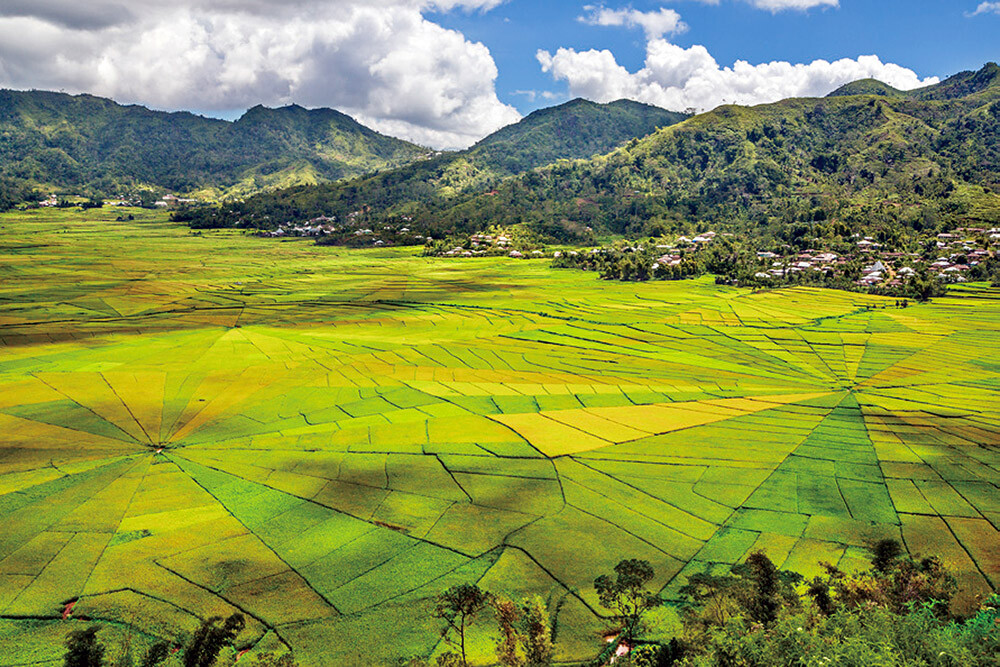
*2 Rather than allowing those closest to water sources to have exclusive access, irrigation water from surrounding mountains and rivers is first channeled to the center of the fields and then distributed outward, ensuring that every plot receives an equal share of water. Any excess water is directed to the outer edges.
The Nazca Plateau: Home of the Magnificent Geoglyphs (Peru)
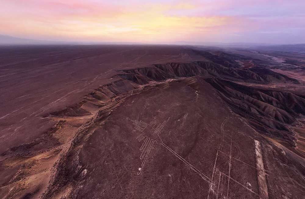
The uplift of the Andes Mountains through tectonic activity raised layers of marine sediments from the seabed, forming a dry plateau at an elevation of approximately 400 m. During the era of the Nazca civilization (from around 100 BCE to 700 CE), numerous enormous geoglyphs depicting hummingbirds, monkeys, and other figures were created on the desert surface of the plateau.
The surface of the Nazca plateau is covered with reddish-brown pebbles containing iron oxides and manganese carried from the Andes Mountains, forming a natural pavement. The lines of the geoglyphs were created by removing these surface stones to reveal the white layer beneath, composed of limestone and silicates of marine origin. Among the driest in the world, the plateau's extremely arid climate has limited erosion, allowing the geoglyphs to remain visible to the present day, even after roughly 2,000 years.
Although the significance of the geoglyphs remains unknown, German archaeologist Maria REICHE revealed that many of the lines correspond with the directions of sunset during the summer and winter solstices, suggesting a connection with astronomical observations and calendars. Their purpose is still debated, but leading theories include their use in religious rituals such as ceremonies to pray for rain, as well as social communication, including information about livestock and trade routes.
The Pisac Valley: Where the Sun Is Held in Place (Peru)
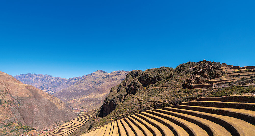
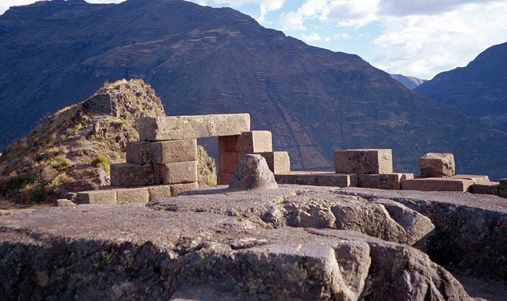
The Pisac valley was formed through the uplift of the Andes Mountains and the erosion caused by glaciers and rivers. Around the 15th century, the Inca Empire took advantage of this unique terrain and fertile land to construct extensive agricultural terraces called andenes. At the Pisac ruins stands a stone pillar known as Intihuatana ("the hitching post of the Sun"). By observing the shadows cast by this pillar, the Incas were able to identify important seasonal turning points, such as the summer and winter solstices, which served as a guide for managing agricultural cycles and timing religious ceremonies.
Salar de Uyuni: A Vast Landscape of Salt (Bolivia)
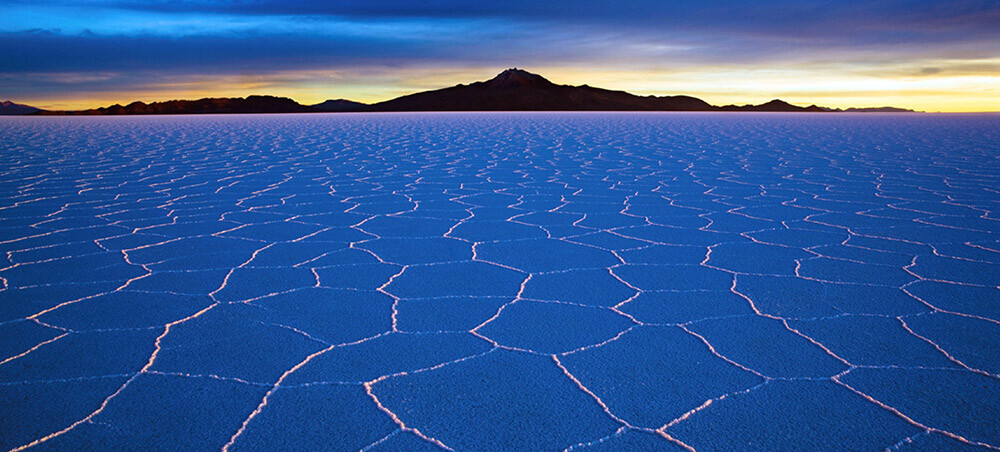
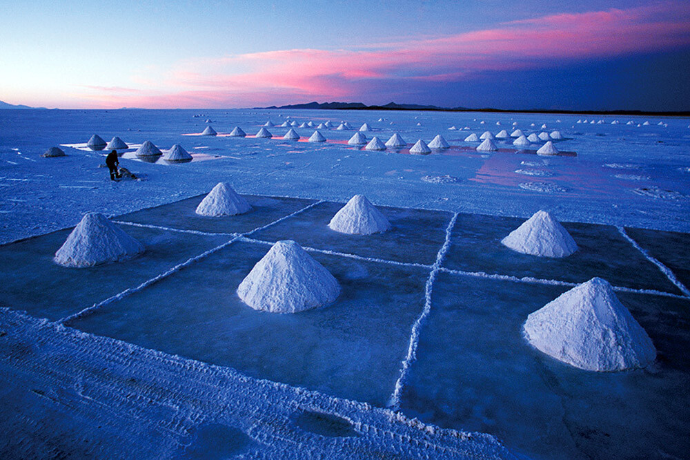
The ancient seawater was trapped between the rising Andes Mountains, where it accumulated in a basin with no outlet rivers. Over many years, evaporation left behind only salt, forming a vast salt flat stretching approximately 100 km from north to south and 250 km from east to west—an area roughly the size of Niigata Prefecture in Japan. With an elevation difference of less than 50 cm across its entire surface, it is known as the flattest place on Earth. The Puna plateau, a high-altitude desert region of the Andes extending from Peru through Bolivia, Chile, and Argentina, is home to numerous other saltern and salt flats. Salt harvested from salt flats is known as "lake salt" and is used primarily for livestock.
- The first page
- Previous page
- page 1
- Current page: page 2
- 2 / 2
The issue this article appears
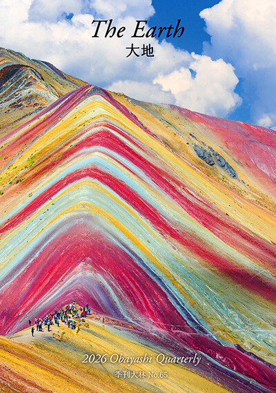
No.65 "Earth"
The earth nurtures life and sustains the rich natural environments that surround us. We live each day benefiting from its blessings. How did the earth come into being? And is there land on planets beyond Earth?
This issue explores the diverse and colorful landscapes found around the world and the ways in which they are intertwined with people’s lives. We also trace the geological processes that have shaped these distinctive landscapes. In the Obayashi Project, we took on the ambitious challenge of conceptualizing the creation of habitable terrain and the development of an environment capable of sustaining life inside a Martian crater.
We reflect on the richness and significance of the natural world nurtured by the earth and turn our thoughts to the future of our planet’s environment.
(Published in 2026)
-
The Colors and Expressions of the Earth
- View Detail
-
Earth's Soil and Planetary Soil
FUJII Kazumichi
(Unit Leader, Soil Homeostasis Research Unit, Fukushima Institute for Research, Education and Innovation) - View Detail
-
Who Owns Land in Space?: Rethinking the Ethics of Terraforming
MOTOMURA Yukiko
(Special Visiting Professor, Faculty of Life and Medical Sciences, Doshisha University; Guest Editor, The Mainichi Newspapers Co., Ltd.) - View Detail
-
Terraforming: Ecosynthesis and Ecological Restoration on Mars
Christopher P. McKay
(Planetary Scientist; Senior Scientist, NASA Ames Research Center) - View Detail
-
OBAYASHI PROJECT
Creating Habitable Terrain on Mars: Crater Paraterraforming
Concept: Obayashi Project Team
- View Detail
-
Dreams of the Red Earth: Five Hundred Years of Martian Settlement
TAKEUCHI Kaoru
(Science Writer; Professor, Faculty of Social Informatics, ZEN University) - View Detail
-
The "Earthen Houses" of Iceland
FUJIMORI Terunobu
(Architectural historian and architect; Director, Tokyo Metropolitan Edo-Tokyo Museum; and Emeritus Professor, University of Tokyo) - View Detail
-
The Earth's Memory: Landscapes Shaped by Nature and Human Life
- View Detail