What Is a Map?
MORITA Takashi
(Professor Emeritus, Hosei University)
Images and maps
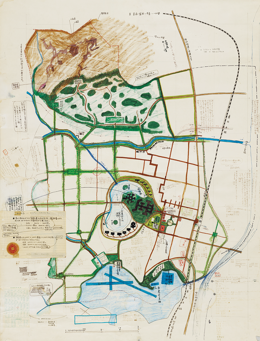
Maps are commonly thought to correspond to real spaces. However, the map of the island in Stevenson's novel Treasure Island (takarajima) does not correspond to any real space. In other words, the narrative unfolds based on the map of a fictitious treasure island. INOUE Hisashi's novel The People of Kirikiri (kirikiri-jin) is also a story about a fictitious country. The author created his own map of Kirikiri, on the basis of which the narrative unfolds.

Kanagawa Museum of Modern Literature Collection.
In this way, as long as a map exists, it is possible to conjure an image of a space from the map even if no such space exists in the real world. There are many instances of this ability being utilized in the world of games, including an old game called sugoroku as well as everything from dedicated devices to smartphones in today's digitalized environment, and even games such as Pokémon GO which coexist with the real world. In addition, various forms of planning such as land planning, urban planning, and architectural planning involve understanding spaces that do not yet exist through maps. There are also statistical maps. These maps depict the spatial distribution of populations and various other statistics. By quantifying conceptual indicators that are not directly visible to the eye, these maps allow such data to be visualized through symbols. In this way, the trends in the spatial distribution of indicators can be understood, and when superimposed on a background map of a road network or other indicators, the correlation between them can be deduced, thereby generating new spatial awareness and expanding the world.
Vision allows us to experience a sense of justification that we have understood something or discovered something through the very act of visual perception. This feeling arises when, in addition to the meaning provided by symbols, our gaze is dynamically directed to form visual patterns that seek out relationships. Maps such as Hokusai's Famous Places on the Tokaido Road in One View (tokaido meisho ichiran) and YOSHIDA Hatsusaburo's Tokyo Big Map (tokyo oezu) have tremendous appeal. They have a structure that serves to direct our gaze more dynamically and evoke images by dispensing with metric requirements.
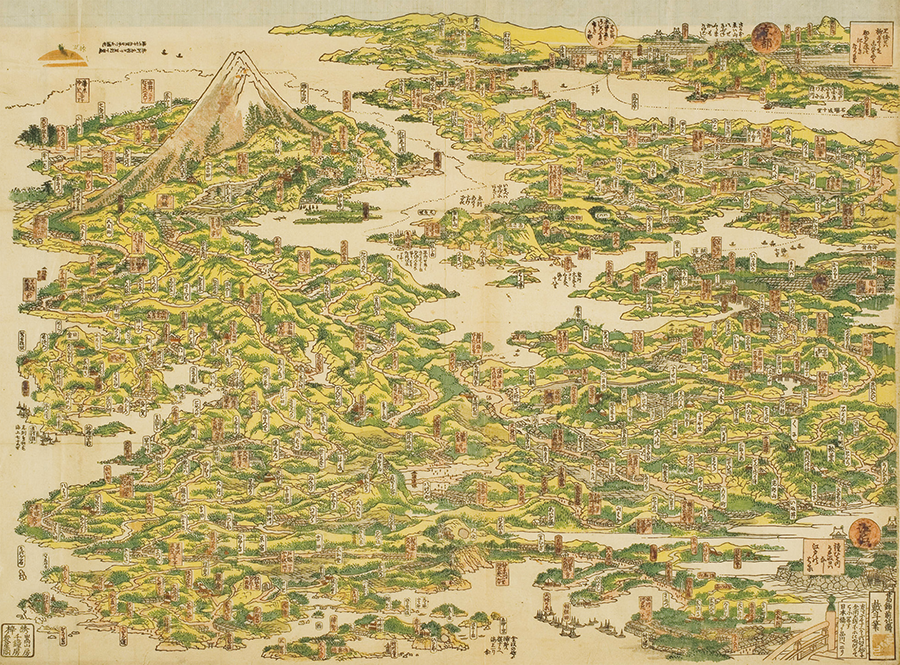
General Library in the University of Tokyo Collection,
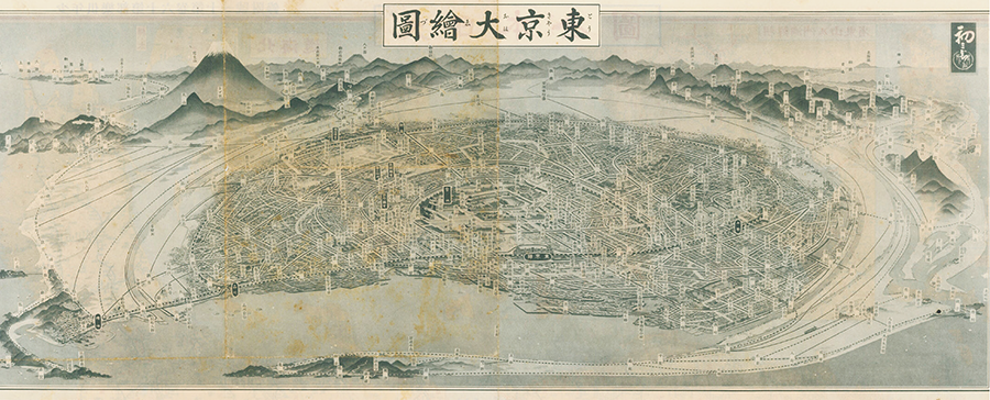
International Research Center for Japanese Studies Collection.
Among the symbols used, arrows can indicate connections and directions, and they are a powerful tool for directing our gaze. In addition, shadows are carefully applied to indicate uneven terrain on a flat surface.
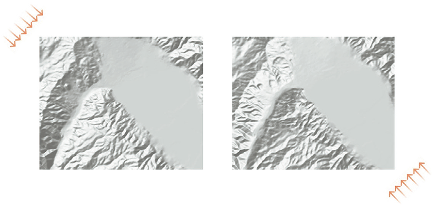
The left figure shows light shining from the upper left to lower right, while the right figure shows light shining from the lower right to upper left for the same digital elevation models. The ridge lines and valleys on the left-hand side of each figure appear to be inverted with respect to the other figure. The same phenomenon may also occur in satellite images.
In this example, the uneven terrain appears to be inverted depending on the way it is illuminated by light. However, there are individual differences in the way unevenness and colors are perceived, as with the surprising effect of the terrain popping out from the two photographs based on stereoscopic perception (*2) of aerial photographs. It is therefore important to keep in mind that semantics as apprehended through our sense organs are not necessarily understood by all individuals. There are no "absolutes" in terms of which cartographic representations are acceptable.
*2 A sense of dimensionality (three-dimensionality) is created by using two photographs of the same area taken from different angles. When the right image is viewed with the left eye and the left image with the right eye, the stereoscopic image can be perceived in the center.
Conclusion
It is gratifying to see that more people are finding maps interesting as they allow us to make various discoveries. With the publication of Encyclopedia of Maps (chizu no jiten) (*3) in 2021, I had hoped that maps would become even more widely used. However, contrary to my expectations, the general reaction of readers was that they are "difficult."
In the "Introduction" section of the encyclopedia, I stated that the coexistence of "hard" and "soft" parts is a major feature of maps. In this paper, I have attempted to expand on what a map is, with a focus on its "soft" parts. Simply put, "hard" maps (practical maps based on precise locations and standardized representation) are metric in nature and are highly usable, while "soft" maps (maps that are not concerned with precise locations or standardized representation, but which provide clear spatial images) serve to stimulate the imagination and facilitate the sharing of images. The profound nature of maps is founded on the manner in which the two complement each other. If AI can support the metric part of maps in the future, people may be able to use maps by further expanding imagination-based features while relying on the support provided by AI. It is my hope that maps will become more interesting going forward.
*3 Edited by MORITA Takashi (eds.), under the supervision of Japan Cartographers Association. (2021). Encyclopedia of Maps (chizu no jiten).
- The first page
- Previous page
- page 1
- Current page: page 2
- 2 / 2
MORITA Takashi
(Professor Emeritus, Hosei University)
Born in 1946. Graduated from the School of Science and Engineering, Waseda University, as well as graduate school at the same department, before completing a doctoral course at the School of Advanced Studies in the Social Sciences (EHESS) in Paris, France (PhD in Information and Communication Sciences). He was former Vice-President of the International Cartographic Association (ICA), former President of the Japan Cartographers Association, and President of the Local Organizing Committee for the 29th International Cartographic Conference (ICC 2019) held in Tokyo. His major publications include Semiotics of Graphics: Processing and Transmission of Information through Visual Language (Gurafikku no kigogaku: shikaku gengo ni yoru joho no shori to dentatsu) (trans.), God’s Eye, Bird’s Eye, Ant’s Eye: Maps as Dream Spaces for Self-Discovery (Kami no me tori no me ari no me: chizu wa jibunsagashi no yume kukan), and Encyclopedia of Maps (Chizu no jiten) (chief ed.). He is a recipient of the French Order of Arts and Letters.
The issue this article appears
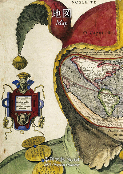
No.64 "Map"
Maps invite people into the unknown, and people get thrilled when presented with one―a simple sheet of paper.
From maps carved into rocks and historically ancient maps used in old times, to digital maps made by satellite in the modern era, we humans have been perceiving the world through a variety of maps.Not only do they help us visualize the world’s shape and overall appearance, but sometimes imaginary worlds are also constructed based on them.
In this issue showcasing various maps, we examine how people have been trying to view the world and what they are trying to see.In the Obayashi Project, we took on the challenge of deciphering and reconstructing in three dimensions a fictional city map called the Hashihara Castle Town Map (Hashiharashi Joka Ezu) drawn by Kokugaku scholar MOTOORI Norinaga when he was nineteen years old.
(Published in 2025)
-
Gravure: Is this also a map?
- View Detail
-
What Is a Map?
MORITA Takashi
(Professor Emeritus, Hosei University) - View Detail
-
The Frontiers of Maps: From the Present to the Future
WAKABAYASHI Yoshiki
(Professor Emeritus, Tokyo Metropolitan University) - View Detail
-
Visible World, Invisible World
OTA Akio
(Professor, Department of Visual Communication Design, College of Art and Design, Musashino Art University) - View Detail
-
The Dreams and Solitude of a Youth Who Drew Maps
YOSHIDA Yoshiyuki
(Honorary Director, Museum of Motoori Norinaga) - View Detail
-
OBAYASHI PROJECT
Deciphering the Hashihara Castle Town Map: The Imaginary Town of MOTOORI Norinaga
Speculative Reconstruction by Obayashi Project Team
- View Detail
-
FUJIMORI Terunobu’s “Origins of Architecture” Series No. 15: Japanese Datum of Leveling Monument
FUJIMORI Terunobu
(Architectural historian and architect; Director, Tokyo Metropolitan Edo-Tokyo Museum; and Emeritus Professor, University of Tokyo) - View Detail
-
Interesting Facts About Maps
- View Detail