
FOCUS: Design Stories
Rokka no Mori Project
![]()
Unlocking the Potential of a Land of Pristine Streams: A Restorative Landscape
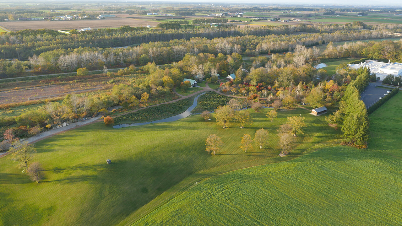
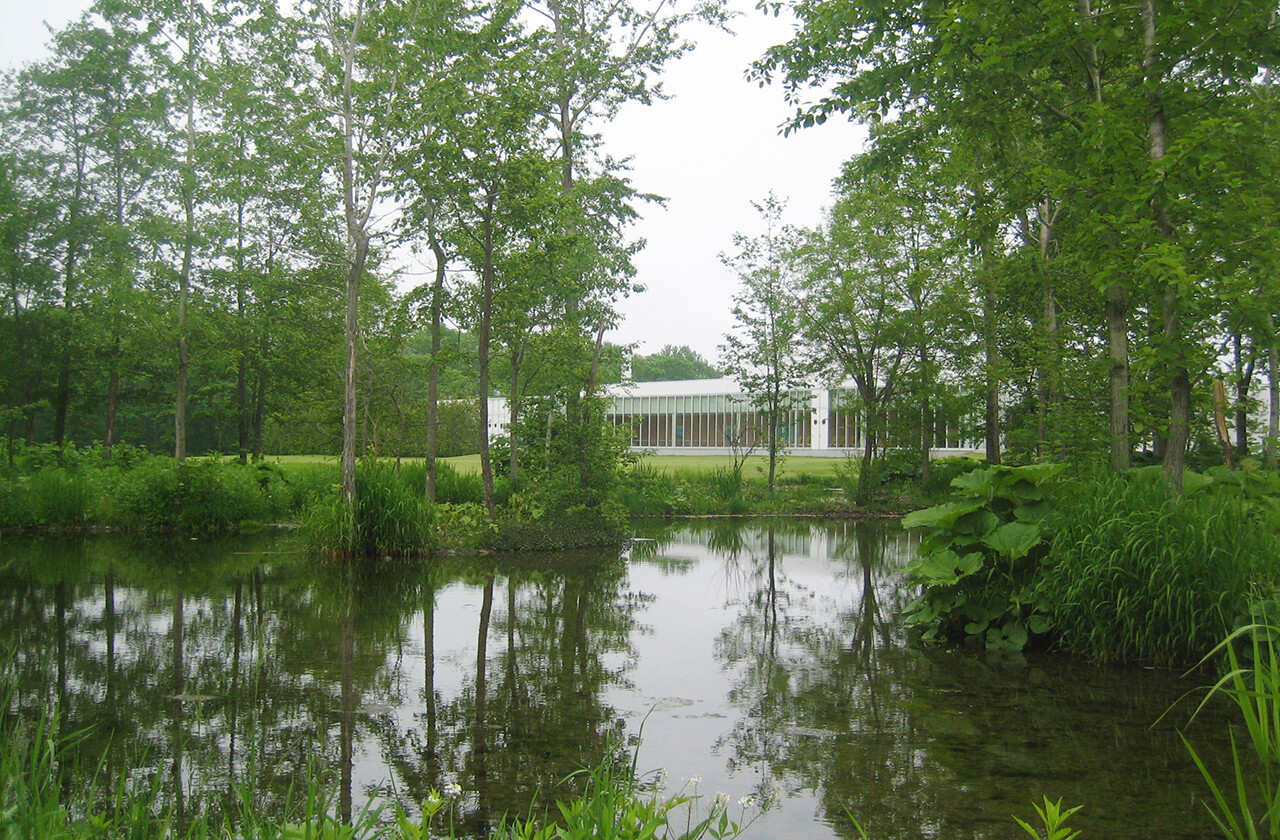
The Rokka no Mori Project is a landscape design project centered on ecological restoration across an expansive, 100,000 m2 site undertaken when Rokkatei, a well-known Hokkaido confectionery manufacturer, built a new factory there.
Landscape design is mainly the practice of planning outdoor spaces to seamlessly blend artificial features with all-natural features, including trees, flowers, plants, soil, rocks, and flowing water.
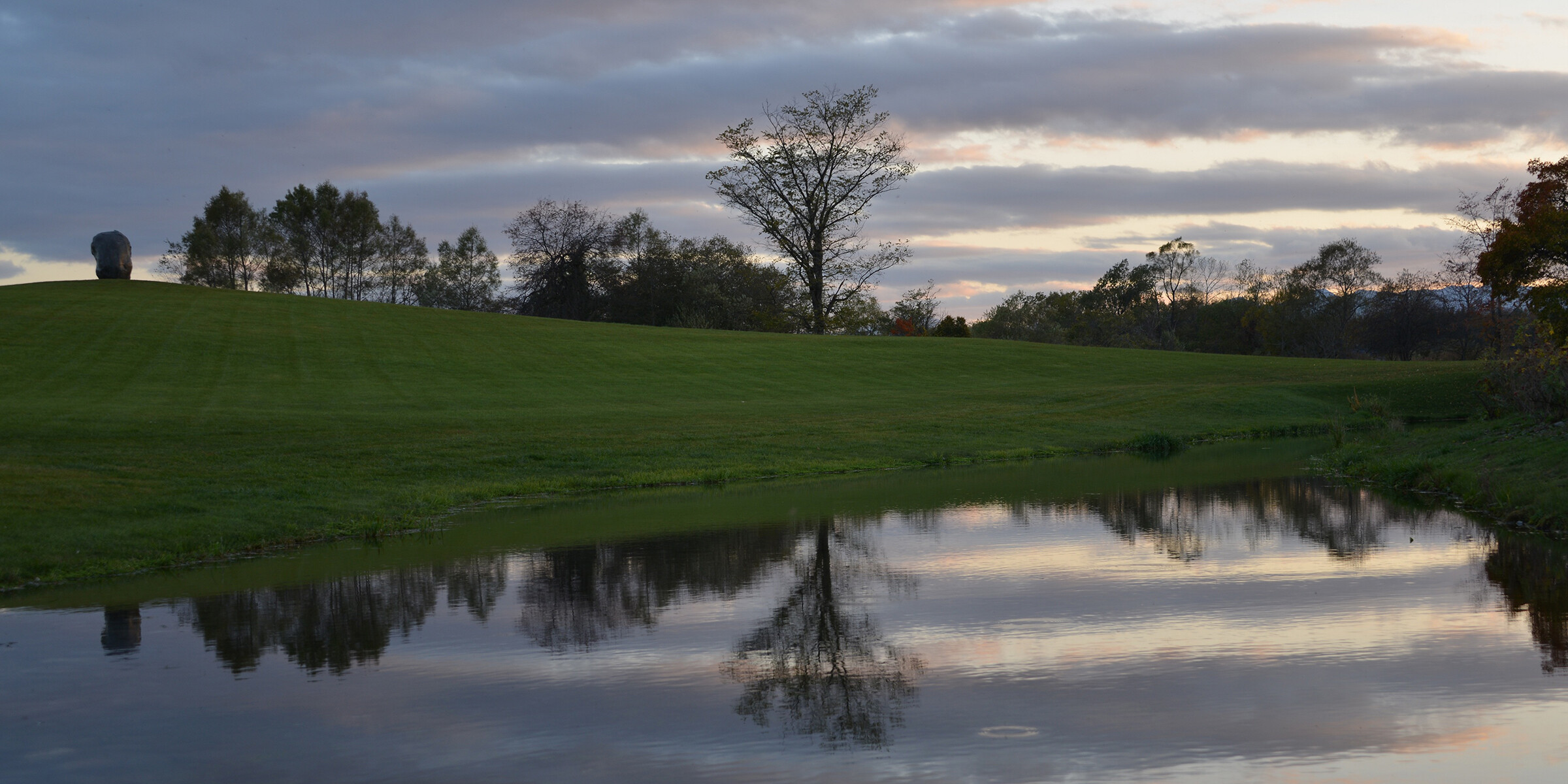
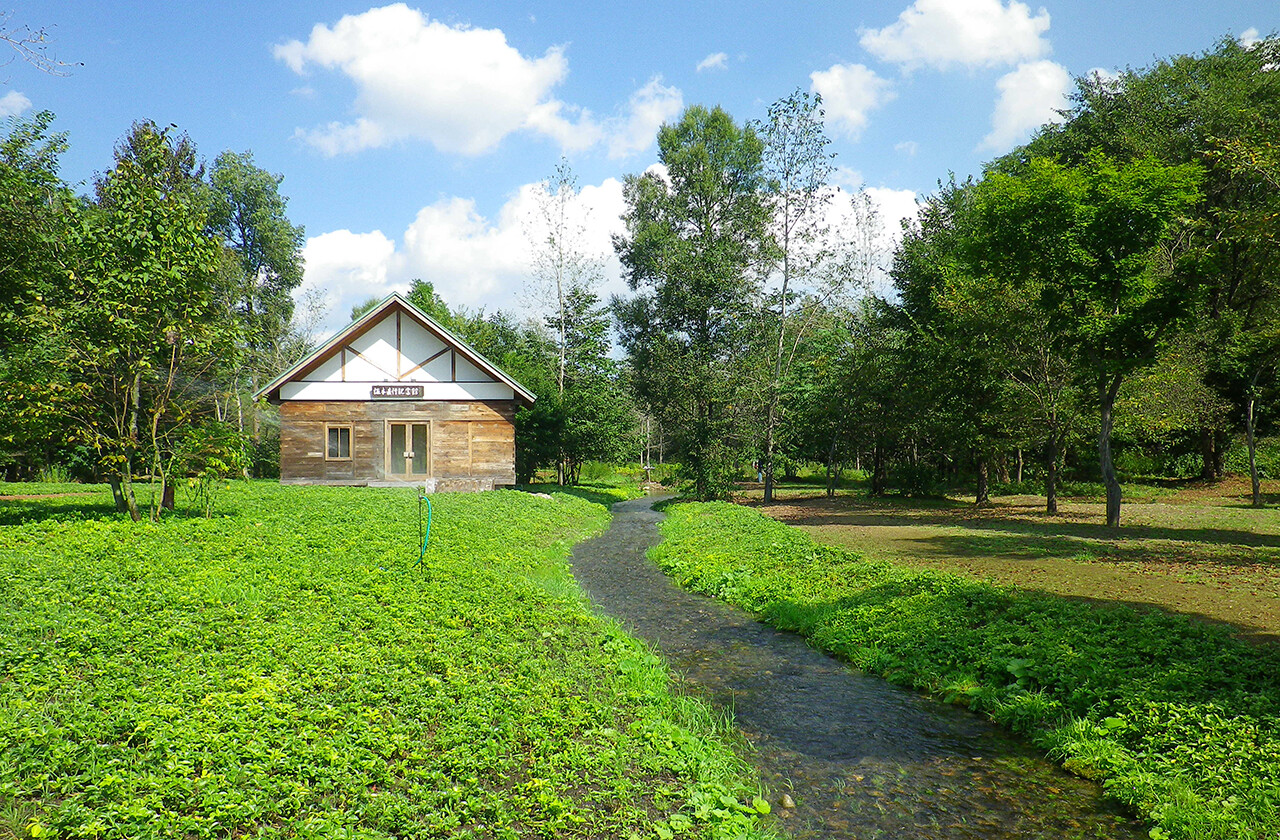
The site, located near Tokachi Obihiro Airport, offers views of Tokachi's mountain range. Flowing nearby is the Satsunai River, a class A river system known for its clear water. When we started surveying the site in 1997, it was a broad expanse of dry land. From that time, 10 long years were spent improving the site's environment before reaching completion in 2007.
Detailed below are the methods we employed in creating a landscape by carefully identifying the site's various environmental resources, such as water and vegetation, while giving consideration to factors including biodiversity and the regional landscape.
Confronting the Dry Land and Learning about the Site
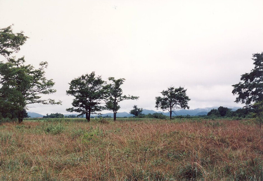
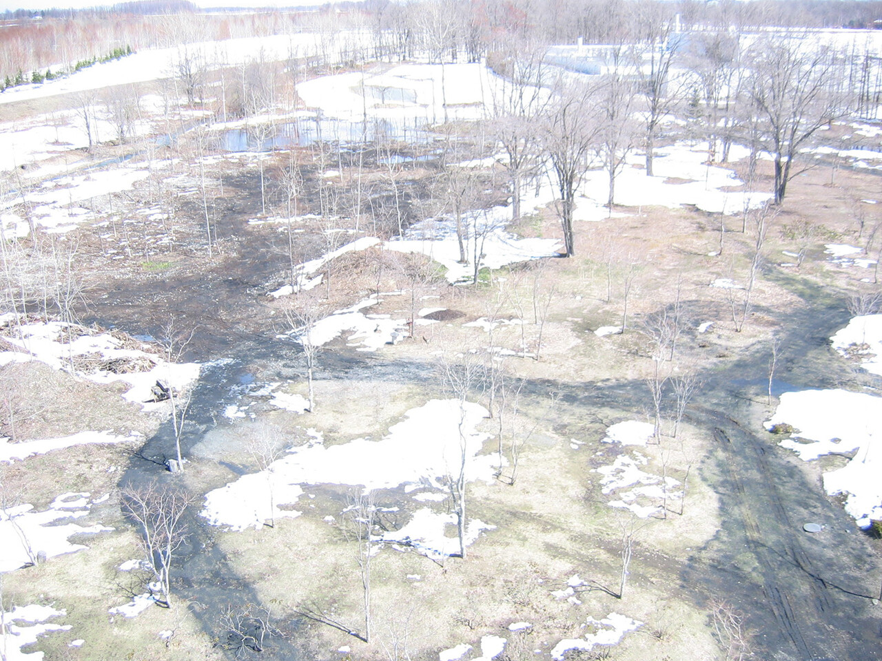
Rokkatei's new factory was completed on this site in 1998, and we began surveying the land in 1997, the previous year.
Originally developed as a large-scale farm, the site was a vast expanse of dry land with a water supply from the Satsunai River cut off by a levee. In the past, however, a river ran through it, and we had also learned that there was abundant subsoil water beneath the surface, fed by the river. Guided by the land's natural features and former river channels, we decided to revive the riverside landscape.
Our site survey also revealed that white trillium (Trillium camtschatcense), a prominent plant of the region, as well as wildflowers including violets were growing in the abandoned forests, despite being covered by varieties of bamboo grasses. We therefore set out to conserve the white trillium and other local vegetation as we worked to revive the streamside landscape.

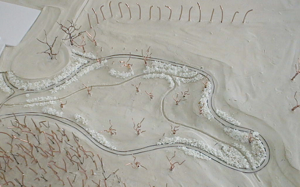
Landscape Diagrams to Unlock the Site's Potential
To explore the optimal relationships among water, plants, topography, trees, and other elements, we organized diagrams that abstractly represent our design methods.
-
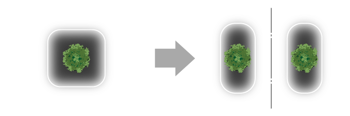
1. Increase ecotones (*1)
Create boundary zones that are rich in variety. -

2. Enhance ecotones
Set up zones to encourage complex interactions among plant communities. -

3. Increase interfaces
Use curves to enhance contact points between different plant communities. -
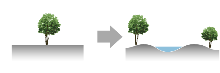
4. Create variety with highs and lows
Develop a more diverse environment. -
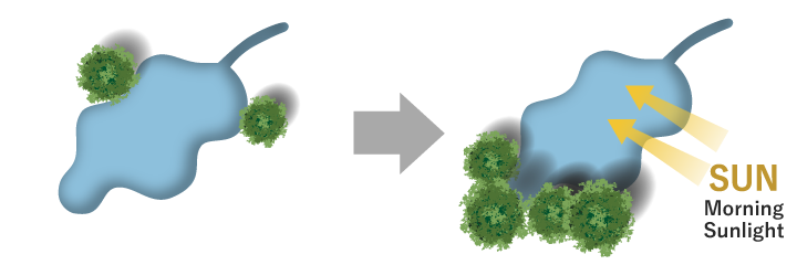
5. Create beneficial shading for wetlands
Allow sunlight to enter from morning to early afternoon and control afternoon sunlight. -

6. Vary the stream's planform and cross-section shapes
Create diversity in the bordering zones
- *1 Ecotone
A transitional area between different biological communities. For example, a waterside ecotone, such as the riverbank, serves as the transition area between terrestrial and aquatic habitats, hosting a diverse array of organisms.
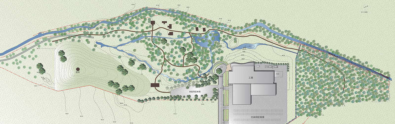
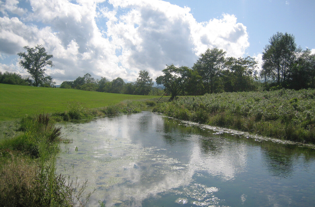
Restoring Watersides and Connecting Green Spaces
The 100,000 m2 site looks flat at first glance due to its vastness, but the terrain was actually rich in subtle variations. In addition to conducting on-site surveys, we analyzed aerial photographs and topographical maps over the decades to identify the characteristics of the site's former river channels (grooves cut into the ground by flowing water), subsoil water, and other environmental resources, as well as the step-like river terraces (fluvial terraces). Using these characteristics to guide us, we regenerated streams and wetlands to create new terrain that could support diverse vegetation.
Process of Forming Streams and Establishing Vegetation
-
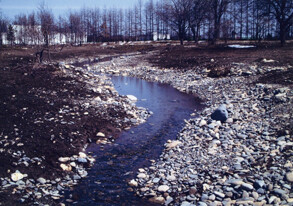
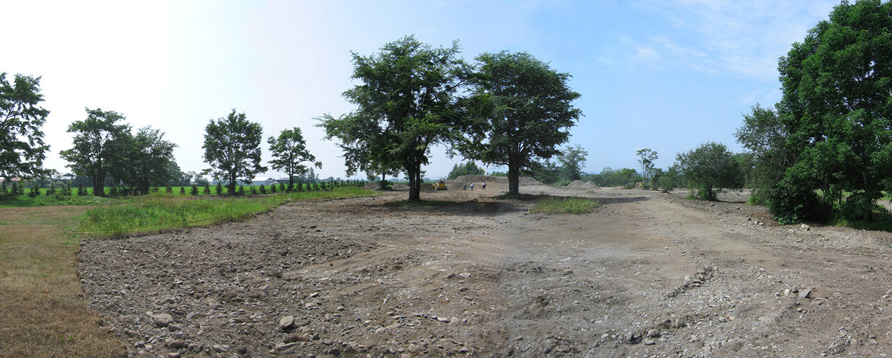
Phase 1: Plants on the ground's surface were stripped to expose gravel and stones. -

Phase 2: Flowing streams were established. -
Phase 3: Bog plants eventually became established.
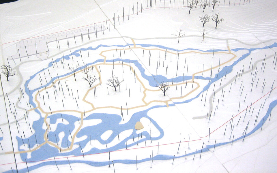
Models for studies created based on identified characteristics. The regenerated streams serve to connect the areas with trees that had been isolated from one another.
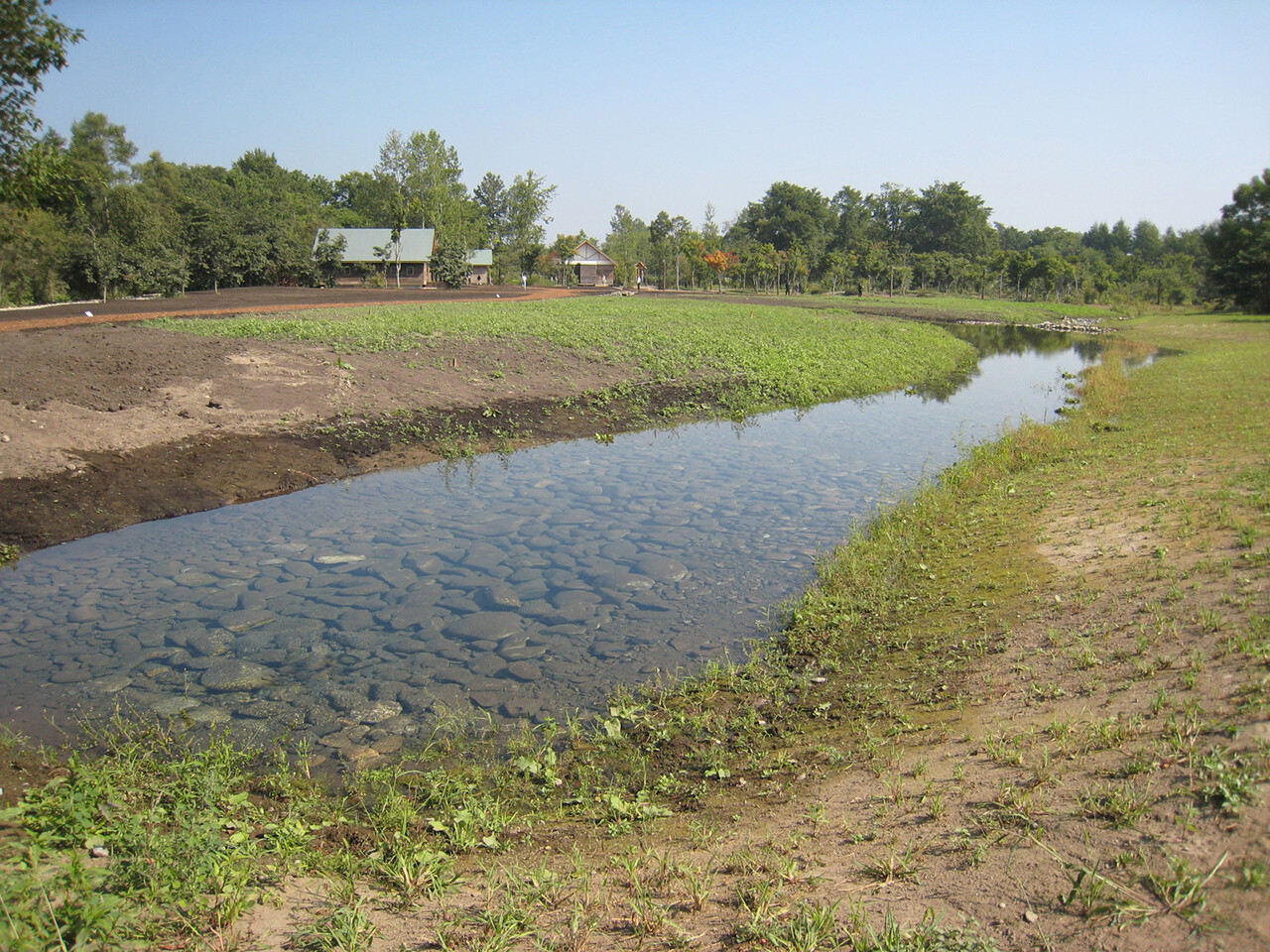
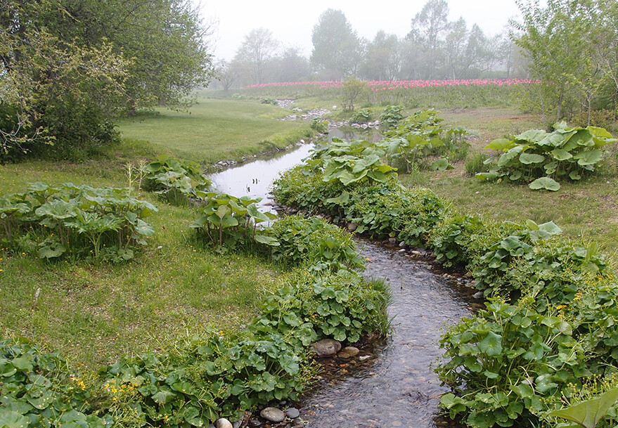
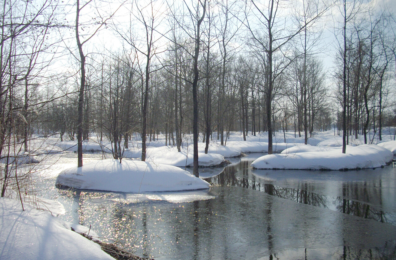
Conserving and Restoring Biodiversity
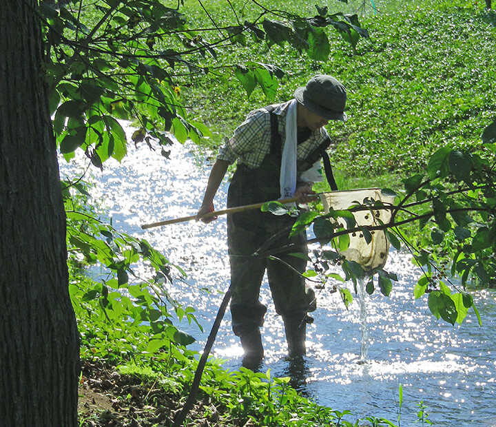
As water flow returned, colonies of diverse plants became established and a rich ecosystem regenerated over time. The restored streams supported vegetation made up of indigenous species, while the Ezo Brown Frog (Rana pirica), Ezo Salamander (Hynobius retardatus), and other local flora and fauna returned, creating a diversified environment.
Examples of Organisms Found during On-Site Surveys between 2010 and 2012
-
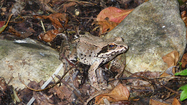
Ezo Brown Frog (Rana pirica) -
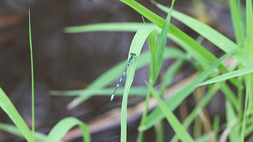
Coenagrion ecornutum -

Scarce Large Blue (Phengaris teleius) -
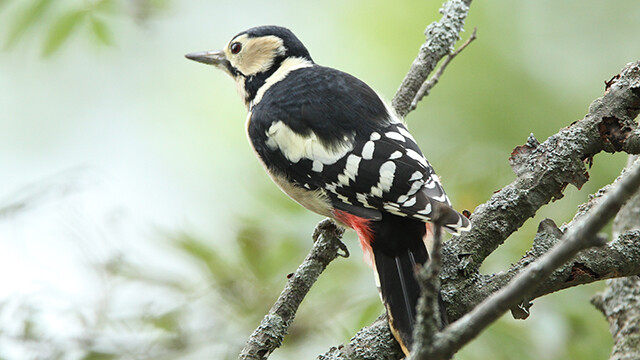
Great Spotted Woodpecker (Dendrocopos major) -
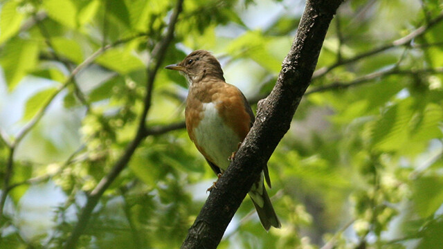
Brown-headed Thrush (Turdus chrysolaus) -
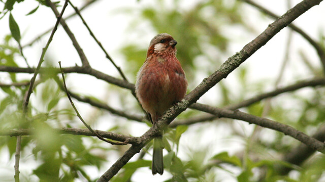
Long-tailed Rosefinch (Uragus sibiricus)
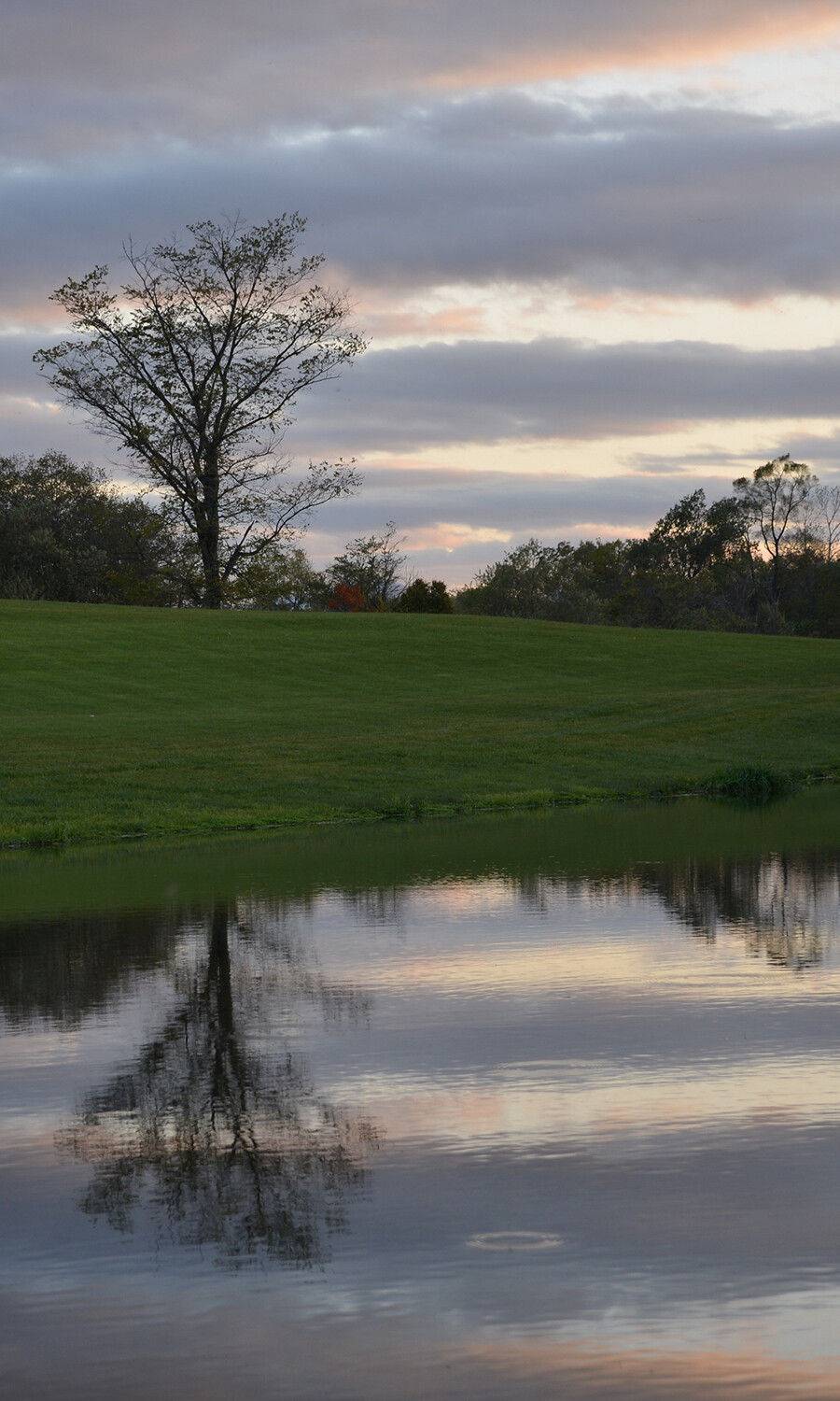
The restored streams have nurtured the landscape over time. Its beauty deepened rather than faded, offering scenes that resonate with visitors.
Note: This page reflects information as of March 2025.